

Beinn Eolaigearraidh Mhor [Ben Eoligarry] [Beinn Eolaigearraidh]
Good walks are even better shared.
Overview
Beinn Eolaigearraidh Mhor (Ben Eoligarry)
Beinn Eolaigearraidh Mhor, affectionately known as Ben Eoligarry, stands at 441 meters, dominating the landscape of the western Isle of Barra. This marvellous Marilyn offers hikers a delightful adventure combining stunning views, challenging terrains, and a sprinkle of Scottish charm.
Geology
The mountain is primarily composed of Lewisian Gneiss, one of the oldest rocks in the world, paired with the iconic Torridonian Sandstone. Together, they tell stories older than most of us care to fathom – perfect for the geology enthusiast or simply anyone keen on impressing their mates with interesting facts!
Routes
Ben Eoligarry Circuit
This moderate circuit begins in the quaint village of Eoligarry, setting the stage for a truly memorable hike. Spanning 8.0 km with an approximate duration of 3.5 hours, it introduces trekkers to the beauty of Scotland’s rugged terrain. Don’t forget your camera; the vistas are Instagram gold!
Summit Features
Upon reaching the summit, hikers are greeted by a modest cairn, where you might momentarily contemplate the existential questions of life while staring out at the breathtaking surroundings. On a clear day, the sight of the Isle of Tiree is simply spectacular!
Terrain Type
Expect a mix of grassy paths interrupted by rocky outcrops, making it an exciting trek for those who enjoy a bit of scrambling along with their walking. It's like nature's own obstacle course!
Views
The views from Beinn Eolaigearraidh are nothing short of spectacular. On clear days, you can take in the stunning sight of the Hebridean islands, with Tiree standing prominently in the distance. The best time to witness these views is during late spring to early autumn, especially just after a refreshing rain shower, when the scenery is vivid, and the air is crisp. Truly a photographer's dream!
Hazards
As always in the Scottish Highlands, one must tread carefully. Be aware of slippery rocks after rain, and never underestimate the possibility of quickly changing weather. A good pair of boots and a keen sense of direction will serve you well!
Nearby Summits
For those seeking further adventures, nearby Beinn Eoligearraidh Beag (354 m) and Eabhag (348 m) are worth exploring. Each boasts its unique charm and scenic vistas.
Access
Reaching Beinn Eolaigearraidh is relatively straightforward, with parking located in the village of Eoligarry accommodating several vehicles. Although public transport options are limited, local services may operate seasonally, so it's advisable to plan accordingly.
Facilities
Facilities near the mountain are limited, but a lovely café in Eoligarry provides refreshments for weary trekkers. Ensure to refuel before or after your hike!
History
The name Beinn Eolaigearraidh means 'Mountain of the hazel trees', a nod to the natural heritage of the area. Historically, it holds significance for its association with local agriculture and Gaelic culture, adding an extra layer of intrigue to your adventure on the mountain.
In conclusion, Beinn Eolaigearraidh Mhor offers a perfect blend of challenge and reward, making it a must-visit for hiking enthusiasts. Just remember to check the weather before you go – no one likes a drenching on their day out!
Explore routes near Beinn Eolaigearraidh Mhor [Ben Eoligarry] [Beinn Eolaigearraidh]
Public walks starting within 80 km of this hill. Nearby does not mean a route reaches the summit; check its map and access before setting out.
Dun Mhulan Broch Quick Walk
View route
Berneray Community Hall to the beautiful beach
View route
Route planning notes
These notes describe possible approaches, not verified navigable routes or permission to cross land. Check current paths, local access rules and conditions before setting out.
Ben Eoligarry Circuit
A scenic loop starting at the nearby village of Eoligarry, offering breathtaking views and a chance to enjoy the rugged Scottish landscape.
Make a day of it, together
Find someone to share the walk with, or organise a day out along a route you like.
Photo Gallery
View all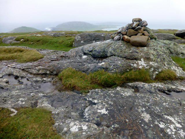 Photo could not load
NF7007 : Beinn Eolaigearraidh Mhor [Ben Eoligarry] [Beinn Eolaigearraidh]
Rude Health
Hill facts and local notes
Classifications
Elevation
105m
344 ft
Prominence
102m
Coordinates
57.0383, -7.4411
NF700073
OS Map
31
Explorer: 452N
At the Summit
The summit boasts a modest cairn and striking views of the surrounding islands and the Atlantic Ocean.
Terrain & Geology
The mountain features a mix of Lewisian Gneiss and Torridonian Sandstone, which tell a tale of ancient geological processes and glacial shaping over millennia.
Views & Scenery
On a clear day, one can see the Isle of Tiree, the stunning sands of the Hebrides, and even the distant silhouettes of the Scottish mainland mountains.
History & Heritage
Name Origin
The name Beinn Eolaigearraidh translates to 'Mountain of the hazel trees', hinting at the flora that once covered the landscape.
Historical Significance
Historically, this area has been significant for its agricultural past and connection to local Gaelic culture.
Getting There & Facilities
Check current local access restrictions, parking rules and transport timetables before travelling. These notes do not confirm public access to the summit.
Parking
A small parking area at Eoligarry provides access to the trailhead, accommodating a few vehicles.
Public Transport
Limited public transport options; best accessed by car. Check local schedules for seasonal services.
Nearby Facilities
Facilities are sparse; however, a quaint café in Eoligarry offers refreshments, and the nearby village contains public toilets.
Safety Information
Known Hazards
- Be cautious of slippery rocks, particularly after rain. Visibility can reduce quickly in changing weather, so keep an eye on the forecast.
General Safety Tips
- Check weather conditions before setting out
- Carry appropriate clothing and equipment
- Let someone know your planned route
- Take a map, compass, and GPS device
- Carry emergency supplies: food, water, first aid kit, torch
Hills
Some common questions about the hills answered
Are there group walks up Beinn Eolaigearraidh Mhor [Ben Eoligarry] [Beinn Eolaigearraidh]?
Many walkers use Walkmates to join or organise walks with others. You can check for group walks around Beinn Eolaigearraidh Mhor [Ben Eoligarry] [Beinn Eolaigearraidh] through the maps
Are there other walkers around Beinn Eolaigearraidh Mhor [Ben Eoligarry] [Beinn Eolaigearraidh]?
Activity varies by location and time, but Walkmates lets you see whether others have shared walks or shown interest in this area. Find other people through the walking friends search walking friends for Beinn Eolaigearraidh Mhor [Ben Eoligarry] [Beinn Eolaigearraidh] search or of course create your own walk for Beinn Eolaigearraidh Mhor [Ben Eoligarry] [Beinn Eolaigearraidh]
Can I organise a walk to Beinn Eolaigearraidh Mhor [Ben Eoligarry] [Beinn Eolaigearraidh]?
Yes. If there aren’t any walks listed already, you can create a walk and make it available for others to join.
If you're signed up to Walkmates, you can create a walk to Beinn Eolaigearraidh Mhor [Ben Eoligarry] [Beinn Eolaigearraidh].
How do I find a walk up this hill?
There are often multiple ways to walk this hill, depending on experience and route preference. Walkmates helps you explore walks and routes that others have shared.
Can I suggest a new route up Beinn Eolaigearraidh Mhor [Ben Eoligarry] [Beinn Eolaigearraidh]?
Yes. You can suggest or create routes to share with others. Walkmates focuses on the social side of walking, so routes are used to help people organise walks and explore areas together, rather than as detailed navigation tools or route libraries.
Other uses really appreciate knowledgeable walkers sharing their routes. Share your favourite route to Beinn Eolaigearraidh Mhor [Ben Eoligarry] [Beinn Eolaigearraidh] here
The is an error or something incorrect about this hill. How do I let you know?
We always strive to keep the information on Walkmates as accurate as possible. If you find an error, please let us know through the contact form and we'll aim to correct it as quickly as possible
Community Discussion
Comments
Location
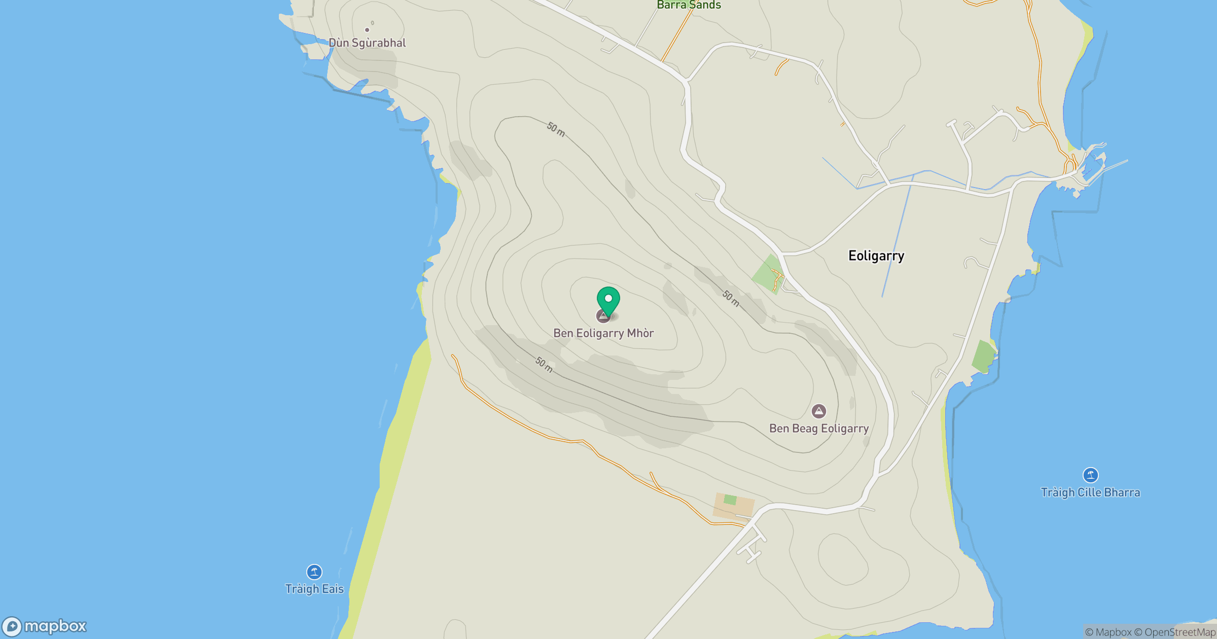
Grid reference: NF700073
View on OpenStreetMapOpens a map in a new tab, centred on the hill.
Hills within 30 km
Straight-line distance, not a walking route or confirmation of access.
No comments yet. Be the first.